Drone Surveys
Drone surveys.
CAA-authorised UAV survey across Glasgow, Edinburgh, Scotland, and UK-wide. Aerial photogrammetry, façade inspection, radiometric thermal imaging, and construction progress monitoring.
Services
Services.
Aerial Photogrammetry
3D mesh models and orthomosaics from overlapping aerial imagery. Ideal for site documentation and volume calculations.
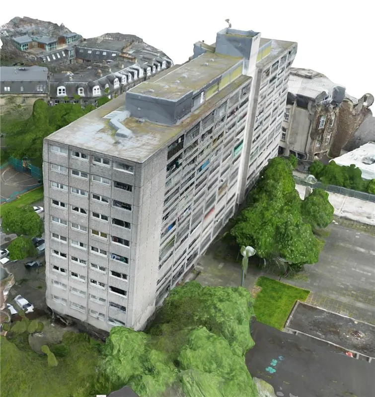
Façade Inspection
High-resolution capture of building façades and hard-to-access elevations. Safer than rope access or MEWP.
Drone Thermography
Radiometric thermal imaging from UAV for roofs, building envelopes, and solar installations.
Progress Monitoring
Scheduled overflights throughout construction to track progress against programme and document as-builts.
Compliance
Compliance & insurance.
Use Cases
What we're flown for.
Roof condition surveys
Full roof inspection without scaffolding or MEWP hire. High-resolution imagery with annotated defect reports.
Façade & high-rise inspection
Sub-centimetre imagery of elevations for condition surveys, cladding assessments, and remediation planning.
Solar PV — feasibility & inspection
Pre-install roof measurement and shading analysis; post-install thermal inspection to find failing panels.
Earthworks & stockpile volumes
Cut/fill and stockpile quantities from photogrammetry — repeatable monthly for valuation certainty.
Construction progress
Scheduled overflights that give the whole project team a dated visual record, comparable month to month.
Planning & site context
Orthomosaics and 3D context models for planning applications, design studies, and stakeholder consultation.
FAQ
Common questions.
Are you CAA-approved? +
Can you fly in urban areas? +
What weather do you need? +
How is the data delivered? +
Related Services
Explore more of what we do.
Matterport Surveys
3D virtual tours, floor plans, and point clouds from one visit
Learn more →Digital Twins
Navigable 3D replicas of buildings and sites
Learn more →LiDAR Scanning
Point cloud surveys from terrestrial, mobile, and UAV LiDAR
Learn more →Measured Building Surveys
CAD floor plans, elevations and sections of existing buildings
Learn more →Scan-to-BIM
LiDAR point clouds converted to Revit models at LOD 200–400
Learn more →Building Performance
Airtightness testing, thermal imaging, and U-values
Learn more →Film, TV & Games
Set, location, and asset scanning for production pipelines
Learn more →Got a site to survey from above?
Send us the location and objective. We'll check airspace, scope the flight, and send a fixed-price quote.