Reality Capture Studio · Glasgow
The world,
captured.
A reality capture studio in Glasgow. Point cloud surveys, Matterport tours, digital twins and scan-to-BIM for architects, engineers and contractors — working UK-wide.
What We Do
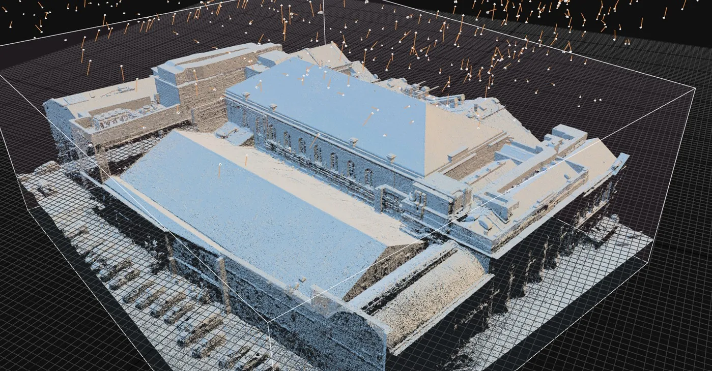
From site to dataset.
Reality capture services for design and construction teams.
Process
Capture. Process. Deliver.
Capture
We deploy the right sensor mix for your site — terrestrial LiDAR, mobile SLAM, Matterport, or UAV — and record existing conditions in millimetre-level detail.
Process
Raw data becomes registered point clouds, cleaned meshes, and coordinated datasets. Quality-checked for accuracy and coverage before delivery.
Deliver
BIM-ready files, digital twins, or 2D drawings — in your preferred format and coordinate system. Support during your design phase included.
Who We Work With
Who we work with.
Architecture Practices
Structural Engineers
M&E Consultants
Project Managers
Main Contractors
Commercial Property & Asset Managers
Heritage & Conservation
Housing Associations
Coverage
Based in Glasgow.
Working UK-wide.
We're on site across Scotland every week — and travel anywhere in the UK for commercial projects and multi-site portfolios. One team, one standard of output, wherever your buildings are.
Get in touch.
Tell us what you're building and we'll come back with a scope and quote.