Every dimension.
Every detail. Captured.
We create millimetre-accurate digital replicas of buildings using LiDAR scanning, photogrammetry, and immersive 3D technology. Whether you need a scan-to-BIM model, a digital twin, or an immersive virtual tour — we capture your building exactly as it is.
Our Services
Six ways to capture your building.
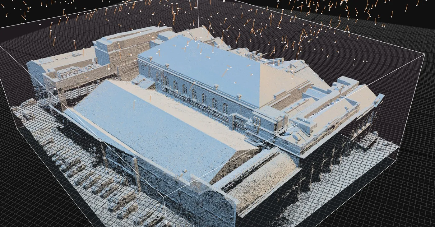
LiDAR Scanning & Point Cloud Surveys
High-density laser scanning that captures millions of measurement points per second. We deliver registered, georeferenced point clouds that serve as the definitive record of your building — accurate to within 0.5mm.
Scan-to-BIM
We convert point cloud data into intelligent Revit models at your required Level of Detail. From LOD 200 concept models to LOD 400 fabrication-ready models, we build BIM assets that your design team can work from immediately.
Matterport 3D Virtual Tours
Immersive, walkable 3D tours that let stakeholders explore your building from anywhere. Perfect for client presentations, remote inspections, facilities management, and marketing.
Digital Twin Creation
A living digital replica of your building that combines 3D spatial data with performance information. Use it for ongoing asset management, planned maintenance, retrofit planning, or as a platform for integrating IoT sensor data.
Heritage & Conservation Recording
Detailed measured building surveys for listed buildings, conservation areas, and heritage assets. We produce records that meet Historic Environment Scotland and ICOMOS documentation standards.
Drone Aerial Surveys & Photogrammetry
CAA-licensed drone surveys for roof inspections, site context photography, photogrammetric modelling, and large-area mapping. We capture perspectives that ground-based surveys simply cannot reach.
Equipment & Technology
Professional-grade tools.
Matterport Pro 3
LiDAR + photogrammetry capture
99% accuracyLeica BLK360
Survey-grade LiDAR scanner
Available for larger projectsDJI Drone Platform
Aerial thermography & photogrammetry
CAA licensedProcessing Suite
ReCap, Revit, CloudCompare, Matterport
Full pipelineWho It's For
Who uses digital capture?
Architects
Accurate as-built data to design from. No more site visits with a tape measure.
Housing Associations
Digital records of stock condition across your portfolio.
Heritage Organisations
Preservation-quality records of listed buildings and conservation areas.
Facilities Managers
Interactive 3D models for maintenance planning and asset management.
Contractors
Clash detection and coordination before you break ground.
Property Developers
Marketing tours and pre-construction documentation.
FAQ
Frequently asked questions
How much does 3D scanning cost in Scotland? +
What's the difference between LiDAR scanning and Matterport? +
What is scan-to-BIM and what LOD do you deliver? +
How long does a typical 3D scanning survey take? +
Do you cover all of Scotland and the UK? +
Need to capture your building?
Tell us about your project and we'll recommend the right approach. No obligation, no jargon.